
When position meets information.
Some call it the game-changing digital twin IoT-connected Opensource-based Web-shared BIM Cloud Virtual…
We call it Openpoint!
Why Precision Matters?
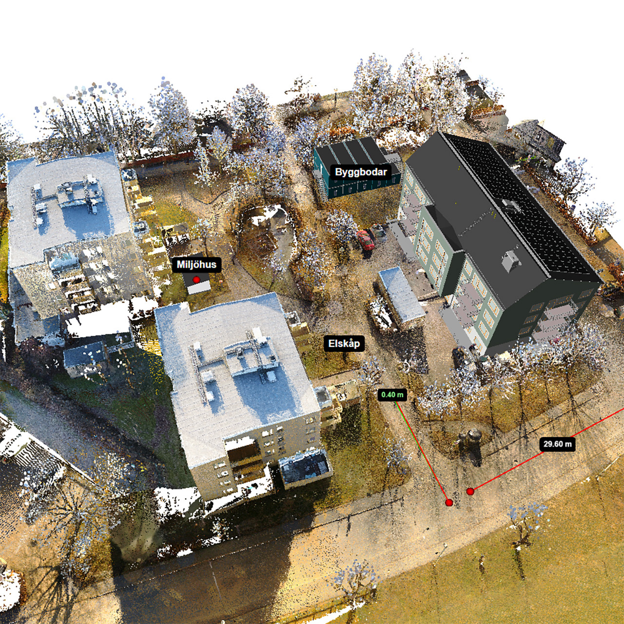
Openpoint provides an interactive platform centered around point clouds and BIM models, delivering digital replicas of physical assets and environments.
With Openpoint’s open API and smart web interface, you can seamlessly connect multiple systems, consolidating everything in one centralized location.
Accurate area verification through laser scanning is crucial for obtaining precise data on space utilization, supporting lease negotiations, energy tracking, and overall project accuracy.
Our user-friendly platform is designed to be flexible across all project phases. Wherever you are in the process, Openpoint’s features will significantly enhance your workflow.
What our customers are saying
An essential tool for Rocmore
We chose Openpoint because the platform's flexibility fits perfectly with our needs in construction.
Fabege – a satisfied Openpoint customer
Before we decided on Openpoint's solution, we looked at several different platforms. We were also in contact with a few other potential partners, but Openpoint's solution felt the most robust and suitable for our type of business.
Some of our Customers & Partners


Openpoint is simple. It’s all about position and information. That’s it.